Palas de Rei – Arzúa stage: Camino Francés guide
Destination: Arzúa
Introduction
It is one of the most pleasant stages of the Camino: eucalyptus woods, Melide’s octopus and, at the end, Arzúa cheese. It is long, but it goes well and you arrive in a town where many people from different routes come together.
Stages
Palas de Rei – Arzúa stage
Book at Casa Buen Camino
Total km
Stay in Arzúa
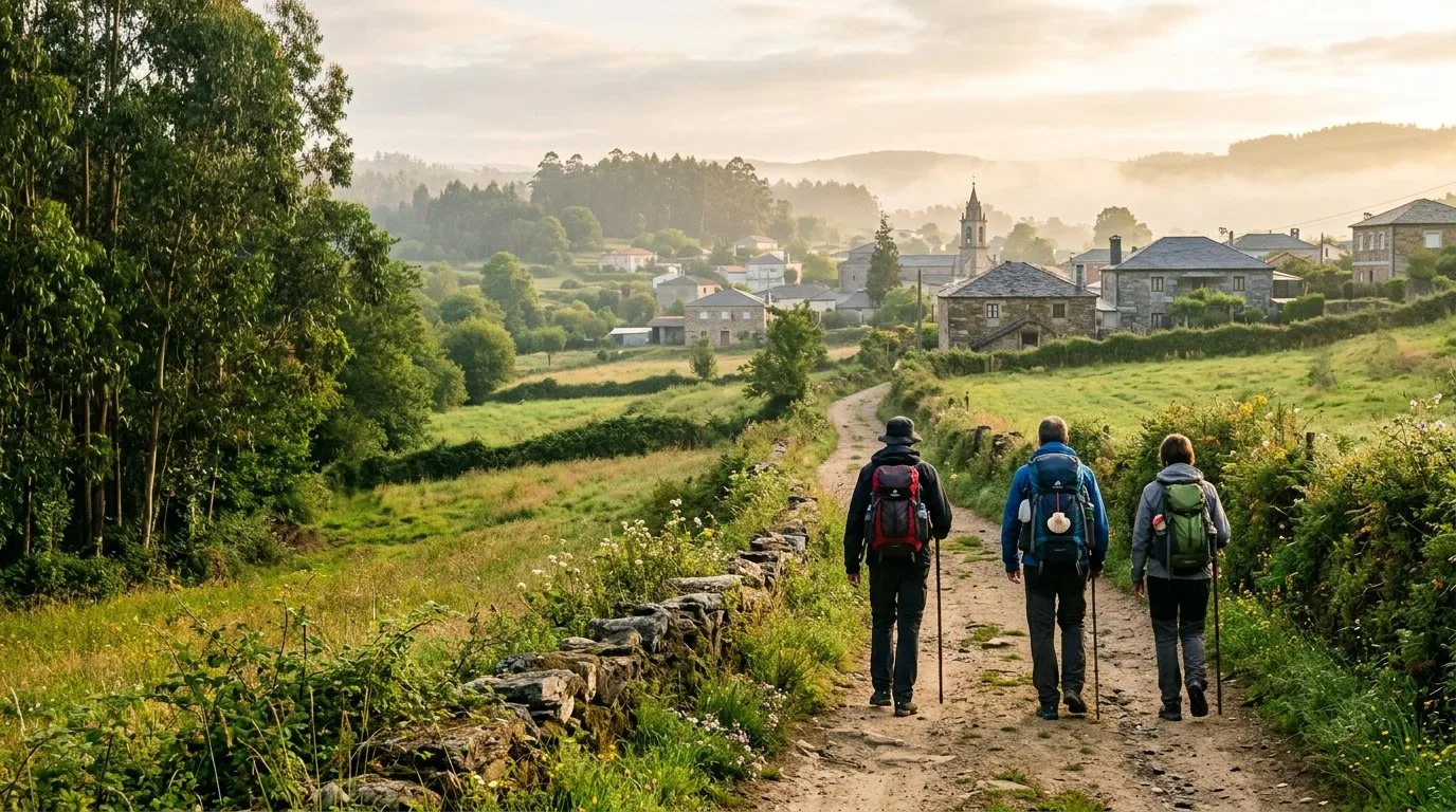
Casa Buen Camino is in Arzúa, right at the end of this stage. After about 29 km, we welcome you with a whole house, quiet and with a terrace, so you can rest properly.
What you will find at the house:
- Location: 400 metres from the centre of Arzúa, with shops and restaurants nearby.
- A house just for you: we rent it whole, for up to 8 people.
- Personal attention: we look after you ourselves, by phone or WhatsApp.
- No rush: book ahead and arrive with your place secured, without searching at the last minute.
Book at Casa Buen Camino
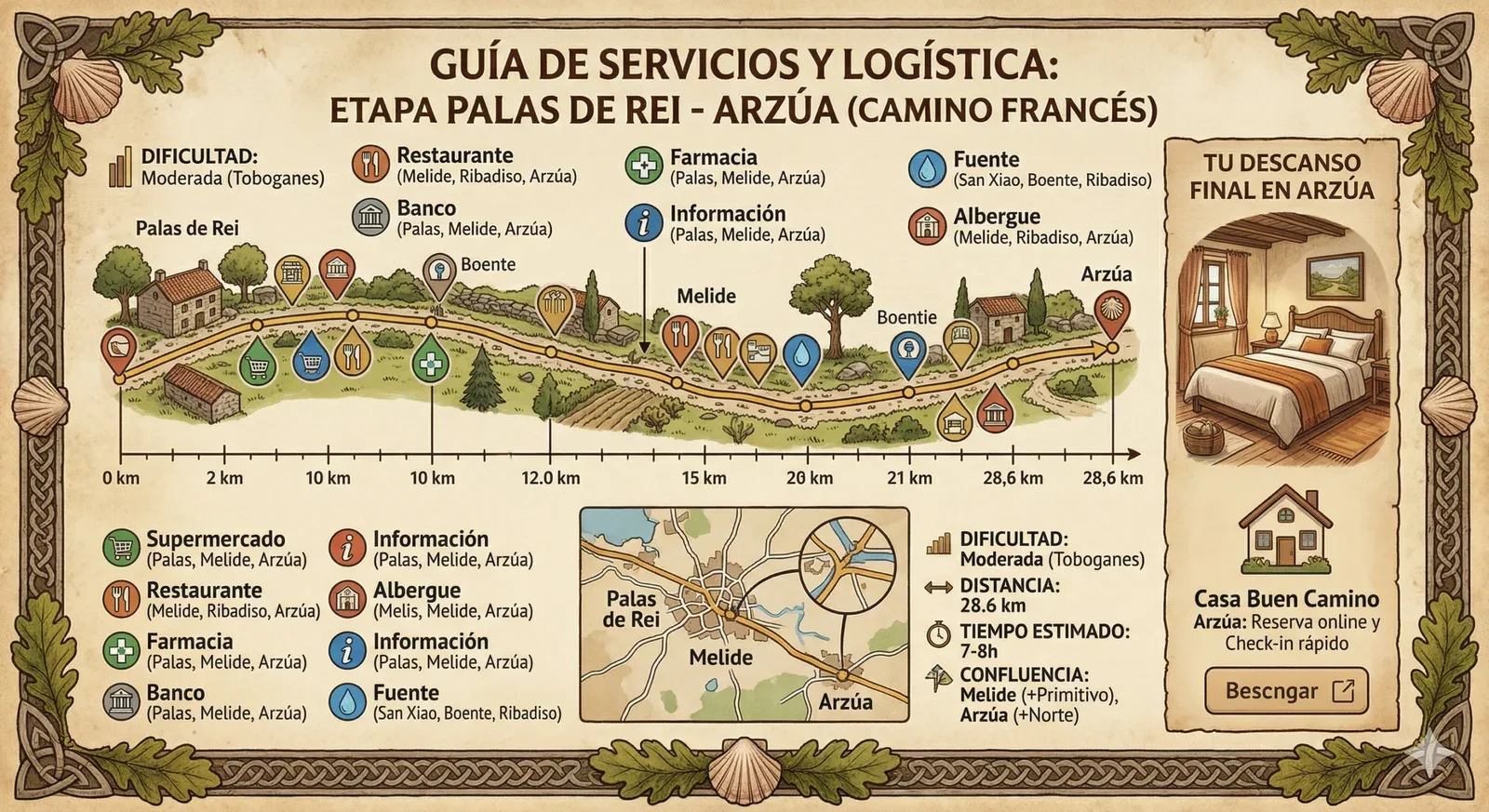
Palas de Rei – Arzúa stage: map and summary
About 29 km of green landscapes, traditional villages and Melide’s octopus (a must-stop), until you drop down to Ribadiso da Baixo and climb up to Arzúa.
Key tip: the descent to Ribadiso is steep, so take it easy. After that there is one last climb to the centre of Arzúa.
Here the Camino Francés joins the Primitivo (at Melide) and the Camino del Norte (at Arzúa). In high season it is very busy, so it is best to book accommodation in good time.
Walking route on Google Maps
Open the route in Google Maps ↗
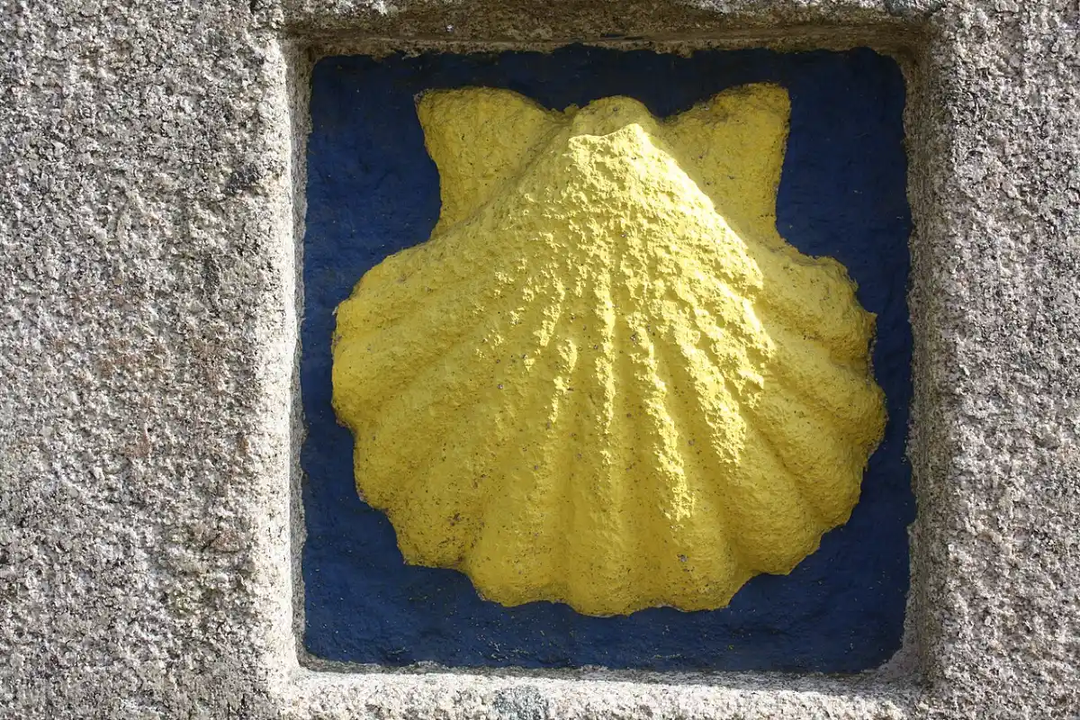
Google’s walking route is a guide only. On the Camino, always follow the yellow arrows.
Stage 31 summary
- Distance: 28.8 km.
- Difficulty: medium-high, because of the ups and downs.
Estimated time: 7 – 8 hours of walking.
Highest point: 554 m (Palas de Rei).
Lowest point: 304 m (Ribadiso da Baixo).
Water points: Plentiful in every village, plus fountains along the way.
- Where routes meet: at Melide (km 14.8) the Camino Primitivo joins, and at Arzúa the Camino del Norte. You will see many more pilgrims than on earlier stages.
- Change of province: at O Coto you leave Lugo and enter A Coruña. Santiago is getting close.
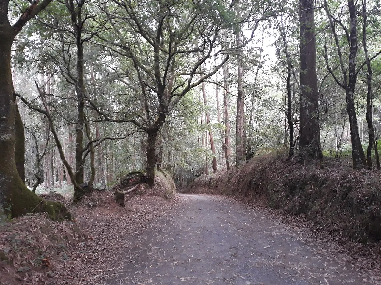
- Terrain and mud: almost all of it is on comfortable tracks and eucalyptus woods, but if it has rained there is mud near the River Furelos. Wear shoes with good grip.
- Highlights: Melide’s pulpo á feira, Ribadiso beside the river and Arzúa cheese.

What to see on the stage
- Furelos medieval bridge: considered one of the prettiest on the Camino, just before entering Melide.
- Food in Melide: it is almost a must to try the pulpo á feira or the melindres. With that fuel you reach Arzúa in good shape, where a good dinner and the town’s cheese await you.
- Ribadiso da Baixo: a lovely spot beside the River Iso. It is the last rest before the final climb to Arzúa.
- Your rest in Arzúa: after almost 29 km, at Casa Buen Camino you can have dinner on our 40 m² terrace with a barbecue and rest in a whole house for your group.

A stage that weighs more than it seems
Even if the odometer says 28.8 km, the constant ups and downs and the tarmac make it feel harder than the numbers suggest.
The profile makes it hard to keep a steady pace. But by now you know Santiago is near, and that helps a lot on the last short climbs before Arzúa.
Watch out for the final climb from Ribadiso. It is a good place to cool your feet, but don’t doze off: there are still about 2.6 km to Arzúa, with one last effort before you reach the flat part.

The stage step by step
1. Leaving Palas de Rei: Military Architecture and Romanesque (0 – 3.4 km)
We set off from km 0 in Palas de Rei. As you leave the town, you will see signs towards Pambre Castle. If you have time, this 5 km detour takes you to the best example of medieval military architecture in Galicia (you can check visits at Turismo de Galicia).
Back on the official route, marker 64 welcomes us to San Sebastián de Carballal. We walk beneath leafy eucalyptus and oak woods on a stretch prone to mud in places like Lacua, where a row of stone slabs saves us from getting bogged down. On reaching San Xulián do Camiño, its 12th-century Romanesque church greets us with its imposing apse.
2. The Pambre Valley and History at Porto de Bois (3.4 – 8.5 km)
We go down a very pretty corredoira towards the River Pambre until we reach Pontecampaña. A lovely stretch follows: a path hemmed in by rocks and twisted branches, the kind that looks straight out of a fairy tale. After passing Casanova, we cross the rego do Vilar at Porto de Bois. This place, peaceful today, was the setting in the 14th century of a bloody dynastic battle between Henry of Trastámara and the Count of Lemos, a struggle that marked the history of the Galician nobility. Shortly after, at Campanilla, we say goodbye to the almost 97 km walked in the province of Lugo.
3. Leboreiro: Entering A Coruña (8.5 – 13 km)
In the village of O Coto we officially enter A Coruña, the last province of our pilgrimage. Soon we reach Leboreiro, the old Campus Leporarius (field of hares) mentioned in the Codex Calixtinus. In Leboreiro we tread the same stretch of Roman road that medieval pilgrims used.
What to see: its stone houses flank the Church of Santa María (transitional Romanesque). In front of it you will see the old Casa de la Enfermería (a 12th-century hospice founded by the Ulloa family) and a curious cabazo, a traditional granary shaped like a giant basket for maize. After crossing the River Seco by its 14th-century bridge, we pass through the business park and finally go down to the River Furelos and its majestic medieval bridge.
4. Melide: The Great Crossroads (14.8 km)
Melide, the geographical centre of Galicia, is where the pilgrims of the Camino Primitivo join us. From here on, we share the path with quite a few more companions.
Don’t miss it: visit the Chapel of San Roque, which keeps the doorway of the former church of San Pedro, and admire its 14th-century cruceiro, considered the oldest in all Galicia.
- The worst bit: the walk through Melide’s industrial estate is a tedious stretch
Culture and Flavour: the old Hospital of Sancti Spiritus now houses the Museo Terra de Melide, a place “of the people and for the people”. After culture comes the ritual: pulpo á feira, served with oil, salt and paprika, alongside traditional sweets such as “ricos” and melindres.
5. Towards Cheese Country: Castañeda and Ribadiso (14.8 – 25.8 km)
We leave Melide crossing the River Catasol towards Boente and its church of Santiago, until we reach Castañeda. Here stood the old lime kilns where medieval pilgrims left the stones carried from Triacastela for the building of the Cathedral as a penance, as mentioned in the Codex Calixtinus. The descent takes us to Ribadiso da Baixo, a very pleasant spot beside the River Iso. After crossing its pretty medieval bridge, you will see the old Hospital of San Antón (15th c.), now restored as one of the prettiest hostels on the Camino.
6. Journey’s End in Arzúa: Augustinian and Cheese-making Tradition (28.8 km)
We finally climb up to Arzúa, where the pilgrims of the Camino del Norte also converge.
In the old town: you will see the ruins of the Convent of La Magdalena (14th c.) and the modern Church of Santiago, which honours the Apostle as Pilgrim and Moor-slayer.
A local tradition: since 1975, Arzúa has celebrated its famous Cheese Festival. After such a demanding stage, a piece of Arzúa-Ulloa cheese goes down wonderfully.
| Point of interest / place | Partial km | Cumulative km | To Arzúa |
|---|---|---|---|
| Palas de Rei (start) | 0,0 km | 0,0 km | 28,6 km |
| San Xulián do Camiño | 3,4 km | 3,4 km | 25,2 km |
| Casanova | 2,3 km | 5,7 km | 22,9 km |
| Leboreiro (entering A Coruña) | 3,5 km | 9,2 km | 19,4 km |
| Melide (pulperías) | 5,2 km | 14,4 km | 14,2 km |
| Boente | 6,0 km | 20,4 km | 8,2 km |
| Castañeda | 2,1 km | 22,5 km | 6,1 km |
| Ribadiso da Baixo (River Iso) | 3,2 km | 25,7 km | 2,9 km |
| ARZÚA (Casa Buen Camino) | 2,9 km | 28,6 km | You’ve arrived! |
Practical tips
- Services: there are plenty of places to eat. It is a stage with lots of infrastructure and lots of company.
- Ribadiso: dipping your feet in the River Iso is the best treatment before the last stretch of tarmac to Arzúa.
- Energy: there is mud in some sections and plenty of tarmac in the sun. Take care with hydration and the state of your feet.
- Leboreiro: look out for the remains of the Roman road.
- Castañeda: this is where lime was prepared for Santiago Cathedral.
- Ribadiso: it is the last place to rest. If it is summer, bring your swimsuit. After that there is a climb of about 3 km to the centre of Arzúa, so don’t get overconfident.
Services along the way
Cash machines: the last one before Arzúa is in Melide.
Health: health centre in Melide and Arzúa (Continuous Care Point).
Pharmacies: Palas, Melide and Arzúa (none in the villages in between).
| Place | Distance (km) | Restaurants | Pharmacy | Cash machine |
| Palas de Rei | 0 | Sí | Sí | Sí |
| Melide | 14,8 | Sí | Sí | Sí |
| Arzúa | 28,8 | Sí | Sí | Sí |
| Service | Location / key point | Contact / local note |
|---|---|---|
| 🚑 Medical emergencies (PAC) | Melide (Cantón San Roque) Arzúa (Rúa de Santiago) | Call 061 or 112 |
| 💊 Pharmacies | Palas, Melide and Arzúa | Last pharmacy before Arzúa: Melide. |
| 🏧 Cash machines (ATM) | Melide (town centre) Arzúa (near the Town Hall) | Avoid running out of cash in the villages. |
| 🚕 Taxis / Transfers | Taxi ranks in Melide and Arzúa | Ideal for backpack transport or if you are tired. |
| ℹ️ Tourist Office | Melide (Pazo de Cogolludo) Arzúa (Rúa de Santiago) | Local information and official stamping. |
| 🏠 Your rest in Arzúa | Casa Buen Camino | Assistance and quick Check-in |
Frequently asked questions
Is it a good idea to split this stage?
Many pilgrims sleep in Melide (km 15) to enjoy the atmosphere, so on the first day they only walk 15 km. It is a good option if you prefer gentler stages, although it takes you away from the traditional stages. If you make it to Arzúa, we are waiting for you at Casa Buen Camino so you can rest.
Where does the Camino Francés meet the Primitivo and the Camino del Norte?
The Primitivo joins at Melide and the Camino del Norte at Arzúa. It is lovely to share stories with people who come from three different routes.
Where to stamp your credential?
We recommend the church of San Xulián, a pulpería in Melide and the church of Santiago in Arzúa. And when you arrive, the Casa Buen Camino stamp is waiting for you at the entrance to the house.
Services sheet: Palas de Rei – Arzúa stage
| Service | Location / Details | Contact / Note |
| Health centre (PAC) | Melide: Rúa Cantón San Roque.
Arzúa: Rúa de Santiago, s/n. | 24h emergencies: 061 / 112 |
| Pharmacies | Palas de Rei, Melide and Arzúa centre. | There are no pharmacies in the villages in between. |
| Cash machines (ATM) | Melide: Abanca, Santander, Caixabank.
Arzúa: town centre (near the Town Hall). |
Next stage: Arzúa – O Pedrouzo
Where to eat in Arzúa
Cheese and octopus. You can’t leave Arzúa without trying Arzúa-Ulloa cheese. Near the centre you will find pulperías (octopus restaurants) and traditional restaurants where the food is very good.
A tip: try the cheese with quince paste for dessert, it’s the classic way.

Culture and traditions
The town and the Camino. Arzúa grew up alongside the Jacobean route. It is a pleasure to stroll through the old town and look into the Magdalena chapel.

Leisure in Arzúa
Nature close by. If you have energy left, head to the Fervenza das Hortas or the Ribadiso recreation area, a lovely spot to rest your feet before the last stage.

What to do in Arzúa
Beyond walking. There are short hiking routes and centres where they show you how cheese and honey are made. A good plan if you take a rest day before reaching Santiago.
Interactive map, elevation and weather for this stage
The stage on the map, its elevation profile and useful tools for the day. The track is approximate: always follow the yellow arrows.
Elevation profile
Swipe to see the full profile →
Tools for the day
- Weather in Arzúa
- Estimate your arrival time
- Sunrise and sunset today
Emergencies: 112 (SOS Galicia). Save the number before you set off.
Track based on open data from OpenStreetMap (© contributors, ODbL) and elevations from an open digital terrain model; values may differ by a few metres. Weather and warnings: MeteoGalicia (Xunta de Galicia). Always follow the yellow arrows and check the official forecast before setting off.
Services on this stage
Shops, pharmacies, ATMs and health centres along the route, listed by kilometre. They also appear as coloured dots on the interactive map above. Slide your finger along the elevation profile to see that point on the map.
📸 The Camino in pictures
A glimpse of what awaits you on the trail.
 Melide
 Melide · Penas
 Boente
 Ribadiso
Photos from Wikimedia Commons, resized.