
Sarria – Portomarín stage: Camino Francés guide
Goal: Portomarín
Introduction
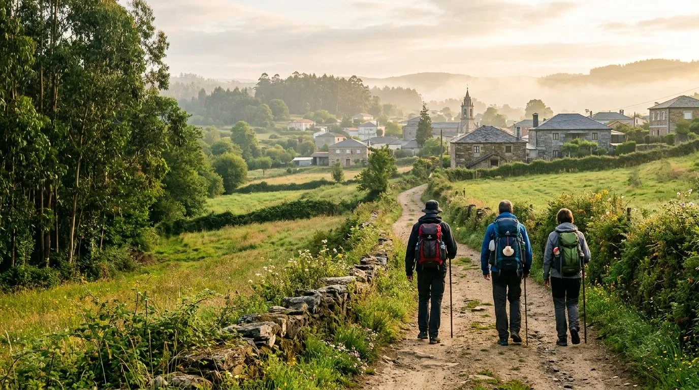
Sarria is the starting point for almost everyone who walks the last 100 km to Santiago. The stage to Portomarín follows corredoiras between oaks and chestnut trees, with gentle ups and downs.
Stages
Sarria – Portomarín stage
Total km
22,4 KM
Stay in Arzúa
Casa Buen Camino is in Arzúa, about 39 km from Santiago. If you are already planning your whole Camino, you can book ahead.
Why book with us:
- Location: 400 metres from the centre of Arzúa, with shops and restaurants nearby.
- Whole house: for your group, up to 8 people.
- Direct contact: we look after you ourselves, by phone or WhatsApp.
- Price: booking direct is 10% cheaper.
Book at Casa Buen Camino
Sarria – Portomarín stage: map and summary
About 22 km along corredoiras (the sunken country lanes between stone walls), oak and chestnut woods and villages such as Barbadelo and Ferreiros, where the km 100 marker stands.
Key tip: the ground goes up and down all the way, but without big climbs. It is best to keep a steady pace and not rush. At the end there is a long descent towards the Belesar reservoir, with views of Portomarín, and you cross the bridge over the Miño.
It is a lively stage: people who start here and people who have come from far away. There are several Romanesque churches where you can stamp your credential.
Walking route on Google Maps
Open the route in Google Maps ↗
Google’s walking route is a guide only. On the Camino, always follow the yellow arrows.
Stage summary
Distance: 22.4 km.
Difficulty: Medium-low (mostly Galician “rollercoaster” terrain: gentle ups and downs).
Estimated time: 5.5 – 6 hours of walking.
Highest point: 660 m (Ferreiros).
Lowest point: 350 m (Portomarín).
Water points: Very frequent. There are plenty of traditional fountains and small bars in every village along the route.
- Atmosphere: the Camino Francés welcomes more people here than anywhere else, so the “Buen Camino!” greetings never stop.
- km 100 marker: it is in Ferreiros and marks the minimum distance on foot to earn the Compostela.
- Terrain and shade: much of it runs along corredoiras and tunnels of oak and chestnut trees. The surface alternates dirt tracks with village tarmac, and there is plenty of shade in summer.
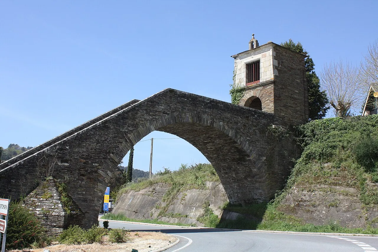
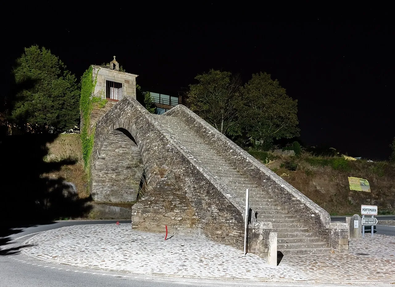
- Highlights: the Romanesque church of Barbadelo, the descent towards the Miño and the arrival in Portomarín up its stone staircase.

What to see on the stage
- Church of Santiago de Barbadelo: Romanesque, a good place for your first stamp before the corredoiras.
- Portomarín tart: the typical almond tart. Local homemade aguardiente is also on offer.
- Belesar reservoir viewpoint: the Miño widens out and you can see Portomarín from above.
- Before leaving Sarria: if you plan to finish your Camino in Arzúa, at Casa Buen Camino we welcome you with an access code and you can keep your bike inside.
Festivals and flavours along the stage
- Sarria: the stew made with Celtic pork has its own festival in late February. At the markets held on the 6th, 20th and 27th of each month, pulpo á feira (Galician-style octopus) is served.
- Portomarín: on Easter Sunday the town holds the Festa da Augardente, the aguardiente festival.

The physical challenge: save your strength for the final stretch
Even if the odometer says 22.4 km, the constant ups and downs tire you more than it seems.
That constant “up and down” along the corredoiras makes it hard to keep a steady pace. In return, on this stage you pass the km 100 marker, which gives you a lift for the last short climbs before the Belesar reservoir.
Take care on the final descent
The descent to Portomarín is steep and hard on the knees before the bridge over the Miño. Then you have to climb the stone staircase up to the centre. Better to take it slowly.
Recommendations
- Water: there are plenty of villages, but carry water for the uphill stretches between Barbadelo and Ferreiros.
- Footwear: many people start here and break in new boots. Wear shoes you have already used.
- No rush: there is no need to reach Portomarín early. The woods and the chat with other pilgrims are worth the time.
- When you need it: if the ups and downs take their toll, stop at any of the bars in the villages.

The stage step by step
1. Sarria to Barbadelo (0 – 4.5 km)
You leave Sarria crossing the Áspera bridge over the River Celeiro and start a demanding climb between chestnut and oak trees. In Barbadelo stands the Romanesque church of Santiago (12th century), with the first stamp of the day. The surface mixes village tarmac and earth.
2. Rente and Mercado da Serra (4.5 – 8.2 km)
You walk along shady corredoiras. At Rente and Mercado da Serra the landscape opens out into meadows and slate walls.
3. Ferreiros and km 100 (8.2 – 11.5 km)
Ferreiros is a parish where the knights’ horses used to be shod.
- km 100 marker: the most photographed one on the route, it marks the minimum distance for the Compostela.
- Terrain: the slope eases and there are hórreos (raised granaries) beside the path.
4. Morgade and Vilachá (11.5 – 19.5 km)
You pass through quiet villages such as Morgade, which has a fountain in the middle of the village, and carry on towards Vilachá.
- What to see: Vilachá is the last village before the big descent. From here the Miño valley opens up. It is worth taking one last break before the way down.
5. Descent and the Miño bridge (19.5 – 21.5 km)
A steep descent along tarmac tracks and paths, so go easy on your knees. You can see Portomarín on the other side of the water. You cross the modern metal bridge over the Miño, and if the reservoir is low you can see the ruins of the old village.
6. Arrival in Portomarín (22.4 km)
To enter the centre you have to climb the stone staircase that leads to the Chapel of Las Nieves.
- What to see: the arcades and the fortress-church of San Nicolás, which was moved stone by stone before the reservoir covered the old valley. This is where you try the almond tart.
- Atmosphere: the squares fill up in the evening and it is easy to run into the people who are walking the same stretch.
| Point of interest / place | Partial km | Cumulative km | To Portomarín |
|---|---|---|---|
| Sarria (start of stage) | 0,0 km | 0,0 km | 22,4 km |
| As Paredes | 2,9 km | 2,9 km | 19,3 km |
| Vilei | 0,8 km | 3,7 km | 18,5 km |
| Barbadelo (Church of Santiago) | 0,8 km | 4,5 km | 17,7 km |
| Rente | 0,8 km | 5,3 km | 16,9 km |
| Mercado da Serra | 2,9 km | 8,2 km | 14,0 km |
| Ferreiros (km 100 marker) | 3,3 km | 11,5 km | 10,7 km |
| Morgade | 1,5 km | 13,0 km | 9,2 km |
| A Pena | 1,0 km | 14,0 km | 8,2 km |
| Vilachá | 5,5 km | 19,5 km | 2,7 km |
| Bridge over the River Miño | 2,0 km | 21,5 km | 0,7 km |
| PORTOMARÍN (end of stage) | 0,7 km | 22,4 km | You’ve arrived! |
Practical tips
- Services: it is the busiest stretch of the Camino Francés, with bars, fountains and hostels in villages such as Vilei or Ferreiros. In high season it is best to book your accommodation in advance.
- The km 100 photo: in Ferreiros there is often a queue at the first marker. A little further on there are shadier spots with fewer people for the photo.
- Energy: 22 km sounds like little, but the profile goes up and down and your calves will notice. Watch out for roots and loose stones, especially if it has rained.
- Barbadelo: the church of Santiago is a gem of Romanesque art, and its stamp is a favourite of people who collect credential stamps.
- Final descent: the way down to Portomarín is steep. Walking poles help take the load off your knees.
- New boots: it is common to see people breaking in new footwear on the first day. Better to wear boots with at least 50 km behind them. Save some strength for the Portomarín staircase.
Services along the way
- Cash machines: in Sarria and in Portomarín. In the villages in between it is hard to find banking services, although most bars at km 100 accept cards.
- Health: there are health centres with emergency care in Sarria and in Portomarín.
- Pharmacies: in Sarria and Portomarín. There are no pharmacies in the 22.4 km between them.
Services along the route
| Place | Distance (km) | Restaurants | Pharmacy | Cash machine |
| Sarria | 0 km | Sí | Sí | Sí |
| Barbadelo | 4,5 km | Sí | No | No |
| Ferreiros (km 100) | 11,5 km | Sí | No | No |
| Morgade | 13,0 km | Sí | No | No |
| Vilachá | 19,5 km | Sí | No | No |
| Portomarín | 22,4 km | Sí | Sí |

Frequently asked questions
Is it a good idea to split this stage?
The stage is 22.4 km long. The terrain is rolling, but most people walk it in one day. If you prefer to go slower or are travelling with children, you can sleep in the Morgade or Ferreiros area (km 11-13), just after the km 100 marker. Even so, reaching Portomarín lets you spend the afternoon beside the Miño.
Which routes come together on this stretch?
In Sarria, pilgrims starting the last 100 km meet those who have been walking from Roncesvalles or from further away. It is the point where the most people come together on the Camino Francés.
Where to stamp your credential?
For the Compostela you need to stamp twice a day over the last 100 km. These are good places:
- Church of Santiago de Barbadelo: one of the Romanesque churches at the start of the route.
- km 100 marker (Ferreiros): many bars nearby have special stamps for this milestone.
- Fortress-church of San Nicolás (Portomarín): the best-known stamp in the town, at the end of the stage.
Services sheet: Sarria – Portomarín stage
| Service | Location / Details | Local note |
| 🚑 Health centre (PAC) | Sarria: Rúa de la Esperanza.
Portomarín: Rúa de San Nicolás. | 24h emergencies: 061 / 112 |
| 💊 Pharmacies | Sarria centre and Portomarín. | Please note: there are no pharmacies in Barbadelo or Ferreiros. |
| 🏧 Cash machines (ATM) | Sarria: plenty in the centre.
Portomarín: in the Plaza Mayor. | There are no cash machines in the villages in between. |
| 🛒 Shops/Supermarkets | Sarria and Portomarín centre. | You will find small grocery shops in Mercado da Serra. |
Next stage: Portomarín – Palas de Rei

Where to eat in Arzúa
Cheese and octopus. You can’t leave Arzúa without trying Arzúa-Ulloa cheese. Near the centre you will find pulperías (octopus restaurants) and traditional restaurants where the food is very good.
A tip: try the cheese with quince paste for dessert, it’s the classic way.

Culture and traditions
The town and the Camino. Arzúa grew up alongside the Jacobean route. It is a pleasure to stroll through the old town and look into the Magdalena chapel.

Leisure in Arzúa
Nature close by. If you have energy left, head to the Fervenza das Hortas or the Ribadiso recreation area, a lovely spot to rest your feet before the last stage.

What to do in Arzúa
Beyond walking. There are short hiking routes and centres where they show you how cheese and honey are made. A good plan if you take a rest day before reaching Santiago.
Interactive map, elevation and weather for this stage
The stage on the map, its elevation profile and useful tools for the day. The track is approximate: always follow the yellow arrows.
Elevation profile
Swipe to see the full profile →
Tools for the day
- Weather in Portomarín
- Estimate your arrival time
- Sunrise and sunset today
Emergencies: 112 (SOS Galicia). Save the number before you set off.
Track based on open data from OpenStreetMap (© contributors, ODbL) and elevations from an open digital terrain model; values may differ by a few metres. Weather and warnings: MeteoGalicia (Xunta de Galicia). Always follow the yellow arrows and check the official forecast before setting off.
Services on this stage
Shops, pharmacies, ATMs and health centres along the route, listed by kilometre. They also appear as coloured dots on the interactive map above. Slide your finger along the elevation profile to see that point on the map.
📸 The Camino in pictures
A glimpse of what awaits you on the trail.
 Sarria
 Portomarín
 Capilla de las Nieves · Portomarín
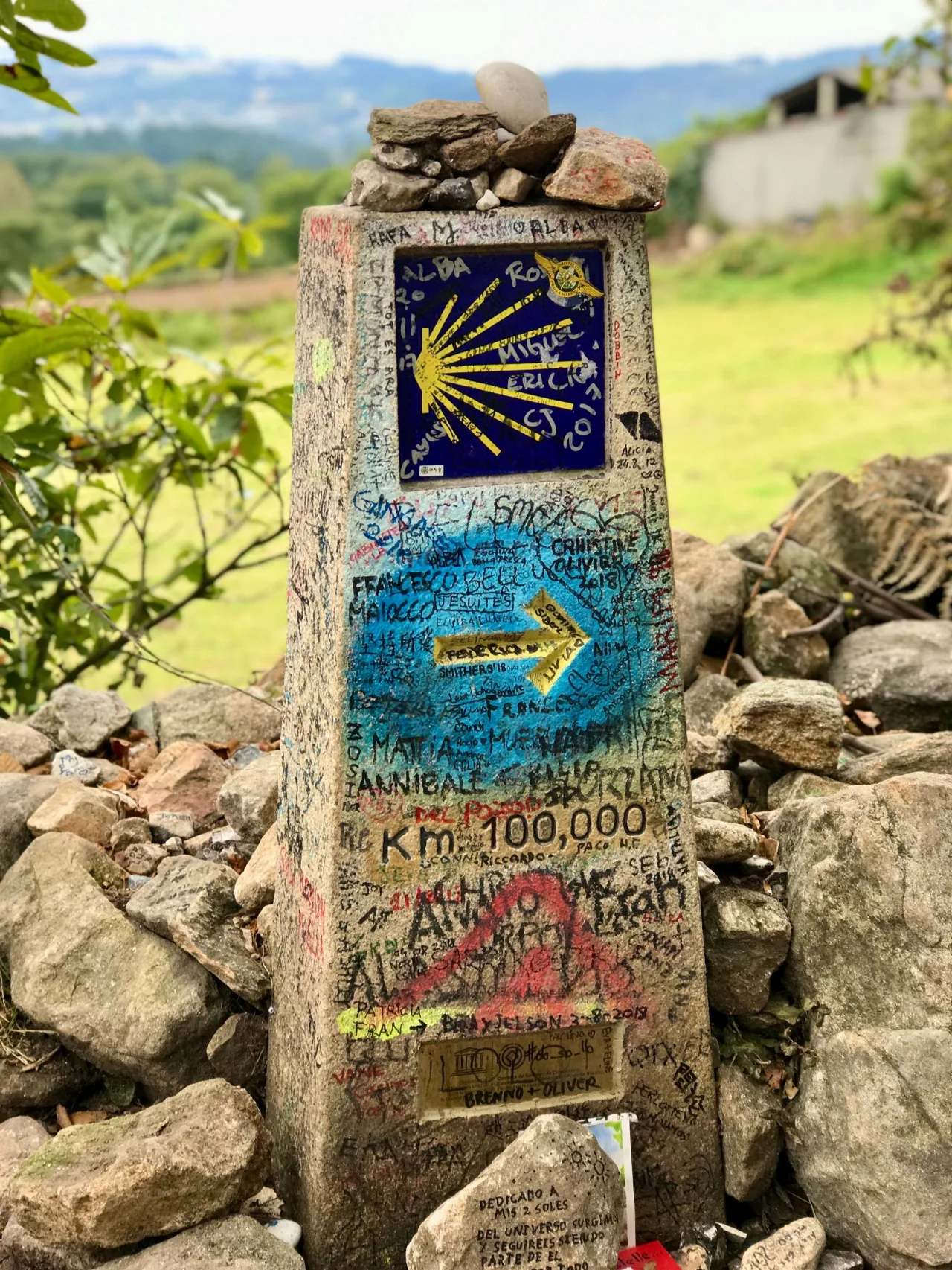 Waymark · Paradela
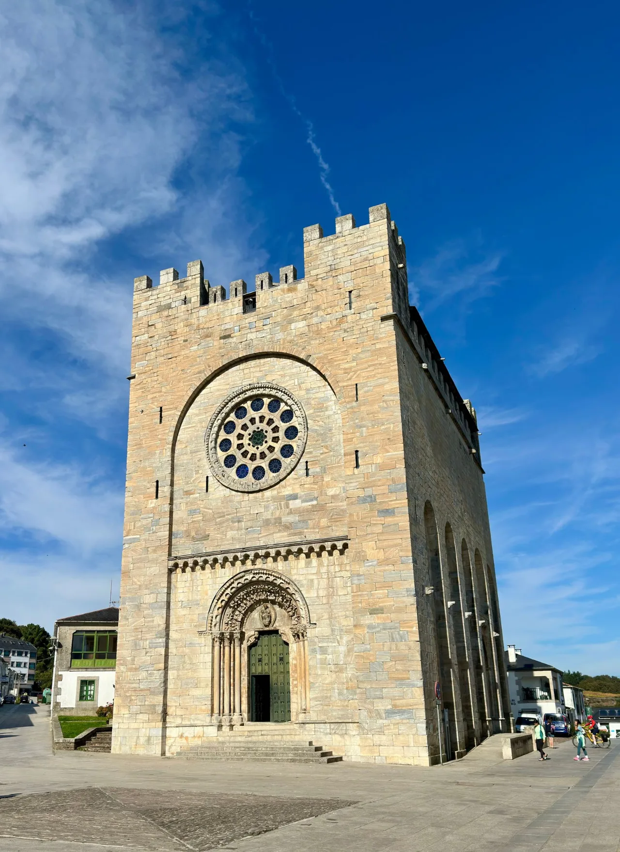 Church · Portomarín
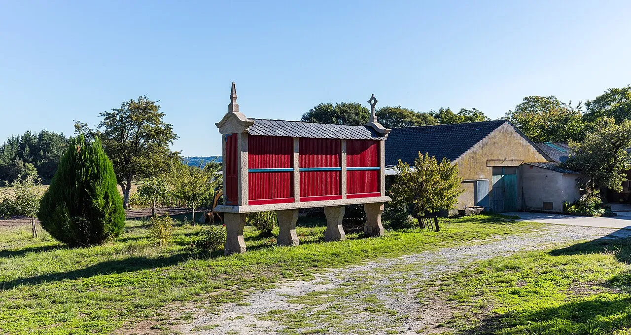 Granary (hórreo) · Barbadelo
Photos from Wikimedia Commons / Pexels, resized.